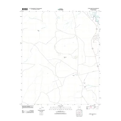
2011 Map of Lyman Lake SW
USGS Topo · Published 2011About this map
Lyman Lake and the Little Colorado River define the northeastern corner of this high-desert landscape in Apache County. This 2011 survey reveals an arid region structured by a network of drainage systems, where water sources are vital landmarks for local ranching operations. Isolated homesteads such as Twentyfour Ranch and Hayrock Ranch are positioned near seasonal watercourses, demonstrating the persistent reliance on groundwater in the Arizona backcountry.
Find a feature on this map
22 named features on this map. Tap any name to fly to it.
Don’t see what you’re looking for? This feature index may not catch every label — zoom into the map to look around manually.
Map Details
Editions of this 2011 Lyman Lake SW Map
This is the sole edition of this map. No revisions or reprints were ever made.
Other maps of this area

1886 · St Johns
USGS Topo · 1:250,000

1892 · St Johns
USGS Topo · 1:250,000

1954 · Saint Johns
USGS Topo · 1:250,000

1957 · Saint Johns
USGS Topo · 1:250,000

1958 · Saint Johns
USGS Topo · 1:250,000

1962 · Saint Johns
USGS Topo · 1:250,000

1968 · Springerville NW
USGS Topo · 1:24,000

1969 · Whiting Knoll
USGS Topo · 1:24,000
1969 · Springerville
USGS Topo · 1:24,000
1971 · Cerro Hueco
USGS Topo · 1:24,000