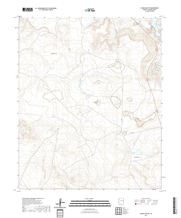
2021 Map of Lyman Lake SW
USGS Topo · Published 2021About this map
Lyman Lake serves as a primary landmark in this high-desert landscape of eastern Arizona, situated at the edge of a vast network of washes and ephemeral water sources. The terrain is defined by drainage patterns like Big Hollow Wash and Chimney Wash, which carve through the plateau toward more significant depressions. This 2021 survey reveals a landscape where water is the central organizing element, from the naming of named cattle ponds and watering holes such as Wiregrass Lake, Straddling Lake, and Woods Lake to the scattered points of Mud Spring and Chimney Spring.
Find a feature on this map
30 named features on this map. Tap any name to fly to it.
Don’t see what you’re looking for? This feature index may not catch every label — zoom into the map to look around manually.
Map Details
Editions of this 2021 Lyman Lake SW Map
This is the sole edition of this map. No revisions or reprints were ever made.
Other maps of this area

1886 · St Johns
USGS Topo · 1:250,000

1892 · St Johns
USGS Topo · 1:250,000

1954 · Saint Johns
USGS Topo · 1:250,000

1957 · Saint Johns
USGS Topo · 1:250,000

1958 · Saint Johns
USGS Topo · 1:250,000

1962 · Saint Johns
USGS Topo · 1:250,000

1968 · Springerville NW
USGS Topo · 1:24,000

1969 · Whiting Knoll
USGS Topo · 1:24,000
1969 · Springerville
USGS Topo · 1:24,000
1971 · Cerro Hueco
USGS Topo · 1:24,000