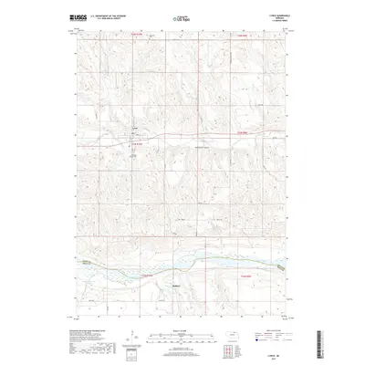
2017 Map of Lynch
USGS Topo · Published 2017About this map
Lynch serves as the primary hub in this northern Nebraska landscape, situated near the winding course of Ponca Creek. The terrain here is defined by the significant transition from the upland plateaus down to the Niobrara River valley, which forms a natural boundary between Boyd and Holt counties. To the south, the settlement of Redbird sits near the confluence of Redbird Creek and the river, an area marked by numerous small tributaries like Louse Creek and Whisky Creek. Local history is anchored by the presence of Highland Cemetery north of town and Pleasant Hill Cemetery to the south. The map illustrates a rural economy dependent on water management and small-scale aviation, evidenced by the Becker Reservoir Number 1 and the Woolf Brothers Airport located along the creek bottoms.
Find a feature on this map
37 named features on this map. Tap any name to fly to it.
Don’t see what you’re looking for? This feature index may not catch every label — zoom into the map to look around manually.
Map Details
Editions of this 2017 Lynch Map
This is the sole edition of this map. No revisions or reprints were ever made.
Other maps of this area

1950 · Dorsey NW
USGS Topo · 1:24,000

1950 · Lynch
USGS Topo · 1:24,000

1950 · Monowi
USGS Topo · 1:24,000

1951 · Bristow
USGS Topo · 1:24,000

1952 · Monowi
USGS Topo · 1:24,000

1952 · Dorsey
USGS Topo · 1:24,000

1954 · Meek NE
USGS Topo · 1:24,000

1955 · O'Neill
USGS Topo · 1:250,000

1959 · O'Neill
USGS Topo · 1:250,000

1964 · Gross
USGS Topo · 1:24,000