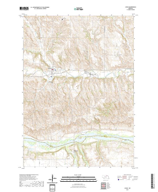
2021 Map of Lynch
USGS Topo · Published 2021About this map
Lynch serves as the primary settlement on this landscape, positioned north of the winding Ponca Creek. The geography is defined by the significant drainage systems of the Niobrara River valley to the south, where the village of Redbird is located near the mouth of Redbird Cr. This modern survey illustrates a rural Nebraska territory where section roads like United Rd and Maly Rd navigate the undulating terrain between river bluffs.
Find a feature on this map
29 named features on this map. Tap any name to fly to it.
Don’t see what you’re looking for? This feature index may not catch every label — zoom into the map to look around manually.
Map Details
Editions of this 2021 Lynch Map
This is the sole edition of this map. No revisions or reprints were ever made.
Other maps of this area

1950 · Dorsey NW
USGS Topo · 1:24,000

1950 · Lynch
USGS Topo · 1:24,000

1950 · Monowi
USGS Topo · 1:24,000

1951 · Bristow
USGS Topo · 1:24,000

1952 · Monowi
USGS Topo · 1:24,000

1952 · Dorsey
USGS Topo · 1:24,000

1954 · Meek NE
USGS Topo · 1:24,000

1955 · O'Neill
USGS Topo · 1:250,000

1959 · O'Neill
USGS Topo · 1:250,000

1964 · Gross
USGS Topo · 1:24,000