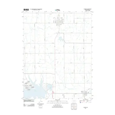
2012 Map of Lyndon
USGS Topo · Published 2012About this map
Lyndon and Melvern anchor this Osage County landscape, illustrating a transition between established agricultural townships and modern recreation. The northern portion of the map is defined by the grid of Lyndon, where the Lyndon Cem and local creek branches like Salt Cr and Jersey Cr provide a look at the area's older settlement patterns. To the south, the influence of the Marais des Cygnes River is evident, particularly where the creation of Melvern Lake has transformed the terrain into a hub for outdoor activity.
Find a feature on this map
56 named features on this map. Tap any name to fly to it.
Don’t see what you’re looking for? This feature index may not catch every label — zoom into the map to look around manually.
Map Details
Editions of this 2012 Lyndon Map
This is the sole edition of this map. No revisions or reprints were ever made.
Other maps of this area

1885 · Burlington
USGS Topo · 1:125,000

1889 · Burlingame
USGS Topo · 1:125,000

1894 · Burlingame
USGS Topo · 1:125,000

1894 · Burlington
USGS Topo · 1:125,000

1947 · Lawrence
USGS Topo · 1:250,000

1950 · Lawrence
USGS Topo · 1:250,000

1956 · Lawrence
USGS Topo · 1:250,000

1957 · Lebo
USGS Topo · 1:24,000

1957 · Waverly NW
USGS Topo · 1:24,000

1957 · Waverly
USGS Topo · 1:24,000