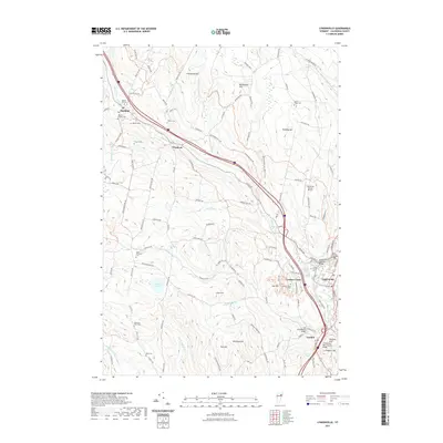
2021 Map of Lyndonville
USGS Topo · Published 2021About this map
Miller Run and the winding Passumpsic River valley define the settlement patterns of this Vermont landscape, where the villages of Lyndonville, Lyndon Center, and Lyndon cluster at the southern end. This area is notable for its preserved historic infrastructure, including several traditional wooden structures such as the Bradley Covered Bridge and the Centre Covered Bridge. To the north, the terrain rises into the hills of Wheelock and Sheffield, where family history is etched into the landscape through numerous small burial grounds like Baptist Hill Cem and the Ingalls-Mosher Cem. The map illustrates the transition from the institutional grounds of Lyndon State College to the higher elevations of Mathewson Hill and Pudding Hill, showing a region that balances academic and agricultural life.
Find a feature on this map
112 named features on this map. Tap any name to fly to it.
Don’t see what you’re looking for? This feature index may not catch every label — zoom into the map to look around manually.
Map Details
Editions of this 2021 Lyndonville Map
This is the sole edition of this map. No revisions or reprints were ever made.
Other maps of this area

1931 · Littleton
USGS Topo · 1:62,500

1932 · Littleton
USGS Topo · 1:48,000

1935 · Littleton
USGS Topo · 1:62,500

1935 · Lyndonville
USGS Topo · 1:48,000

1938 · St. Johnsbury
USGS Topo · 1:48,000

1939 · Lyndonville
USGS Topo · 1:62,500

1943 · St. Johnsbury
USGS Topo · 1:62,500
1949 · St. Johnsbury
USGS Topo · 1:62,500

1950 · Lake Champlain
USGS Topo · 1:250,000

1950 · Lewiston
USGS Topo · 1:250,000