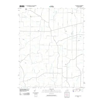
2010 Map of Lynn Grove
USGS Topo · Published 2010About this map
Browns Grove and the surrounding Calloway County countryside are defined by a complex network of waterways and family burial grounds in this 2010 study. The drainage patterns of Mayfield Creek and the West Fork Clarks River carve through the agricultural landscape, joined by numerous tributaries including Jackson Creek, Cooter Creek, and Sand Creek. This area preserves a high density of family and community history, evidenced by the many cemeteries scattered across the township, such as Brush Island Cemetery, Waterfield Cemetery, and Young Cemetery. The road network follows a typical rural grid but remains deeply tied to local names, with routes like Burnetts Chapel Rd and Old Lynn Grove Rd connecting the various farms and homesteads near the Tennessee border.
Find a feature on this map
78 named features on this map. Tap any name to fly to it.
Don’t see what you’re looking for? This feature index may not catch every label — zoom into the map to look around manually.
Map Details
Editions of this 2010 Lynn Grove Map
This is the sole edition of this map. No revisions or reprints were ever made.
Other maps of this area

1936 · Conyersville
USGS Topo · 1:24,000

1936 · Farmington
USGS Topo · 1:24,000

1936 · Hazel
USGS Topo · 1:24,000

1936 · Crossland
USGS Topo · 1:24,000

1936 · Lynn Grove
USGS Topo · 1:24,000

1936 · Dexter
USGS Topo · 1:24,000

1936 · Kirksey
USGS Topo · 1:24,000

1950 · Puryear
USGS Topo · 1:24,000

1950 · Cottage Grove
USGS Topo · 1:24,000
1951 · Hazel
USGS Topo · 1:24,000