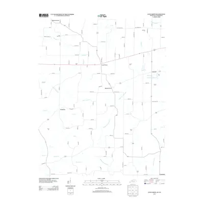
2013 Map of Lynn Grove
USGS Topo · Published 2013About this map
Lynn Grove and Harris Grove anchor this section of Calloway County, where the landscape is defined by the intricate branching of the Middle Fork Clarks River and E Fork Terrapin Cr. The map reveals a high density of rural burial sites, essential for family historians tracing local lineages through Brush Island Cem, Young Cem, and Waterfield Cem. Smaller hubs like Protemus and Wiswell are connected by a network of named roads such as Old Lynn Grove Rd and Jones Sparkman Rd, reflecting the community's agricultural layout. In the southern reaches, the land slopes toward the Tennessee state line near Crossland, with drainage provided by the Sand Fork Cr and Pleasant Grove Cr. This survey provides an exact look at property-access routes and water sources that have shaped this borderland for generations.
Find a feature on this map
102 named features on this map. Tap any name to fly to it.
Don’t see what you’re looking for? This feature index may not catch every label — zoom into the map to look around manually.
Map Details
Editions of this 2013 Lynn Grove Map
This is the sole edition of this map. No revisions or reprints were ever made.
Other maps of this area

1936 · Conyersville
USGS Topo · 1:24,000

1936 · Farmington
USGS Topo · 1:24,000

1936 · Hazel
USGS Topo · 1:24,000

1936 · Crossland
USGS Topo · 1:24,000

1936 · Lynn Grove
USGS Topo · 1:24,000

1936 · Dexter
USGS Topo · 1:24,000

1936 · Kirksey
USGS Topo · 1:24,000

1950 · Puryear
USGS Topo · 1:24,000

1950 · Cottage Grove
USGS Topo · 1:24,000
1951 · Hazel
USGS Topo · 1:24,000