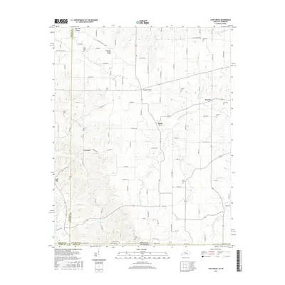
2016 Map of Lynn Grove
USGS Topo · Published 2016About this map
The Tennessee Valley Divide cuts through this rural landscape in southwestern Calloway County, marking the high ground between distinct drainage basins. The small community of Lynn Grove sits at a central crossroads, surrounded by smaller settlements like Wiswell, Harris Grove, and Protemus. The area is characterized by a dense network of country lanes such as Burnetts Chapel Rd and Beech Grove Rd, which connect numerous family-named burial sites that speak to the region's deep genealogical roots.
Find a feature on this map
100 named features on this map. Tap any name to fly to it.
Don’t see what you’re looking for? This feature index may not catch every label — zoom into the map to look around manually.
Map Details
Editions of this 2016 Lynn Grove Map
This is the sole edition of this map. No revisions or reprints were ever made.
Other maps of this area

1936 · Conyersville
USGS Topo · 1:24,000

1936 · Farmington
USGS Topo · 1:24,000

1936 · Hazel
USGS Topo · 1:24,000

1936 · Crossland
USGS Topo · 1:24,000

1936 · Lynn Grove
USGS Topo · 1:24,000

1936 · Dexter
USGS Topo · 1:24,000

1936 · Kirksey
USGS Topo · 1:24,000

1950 · Puryear
USGS Topo · 1:24,000

1950 · Cottage Grove
USGS Topo · 1:24,000
1951 · Hazel
USGS Topo · 1:24,000