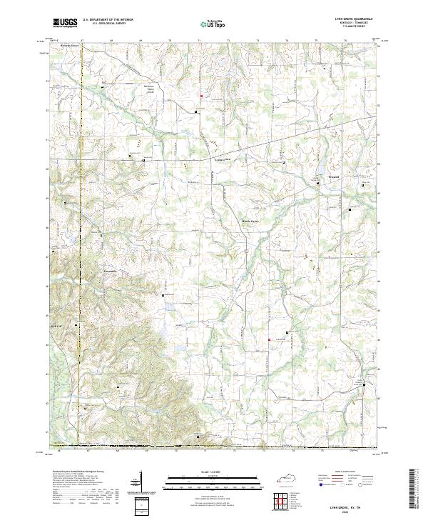
2022 Map of Lynn Grove
USGS Topo · Published 2022About this map
Lynn Grove and the surrounding rural landscape sit along the Tennessee Valley Divide, where the waters of the Middle Fork Clarks River and Mayfield Cr originate. This Calloway County quadrangle captures a dense network of country roads and family cemeteries that speak to generations of settlement. In the northern reaches, Browns Grove and Salem Cem mark the local topography, while the southern edge follows the Kentucky-Tennessee state line near Bell City. The area is defined by its small crossroads communities like Harris Grove and Wiswell, and numerous church-related landmarks such as Story Chapel and the South Pleasant Grove Cem. The map provides an exceptionally detailed look at the rural land divisions and cemetery locations essential for genealogical research in this part of the Purchase region.
Find a feature on this map
107 named features on this map. Tap any name to fly to it.
Don’t see what you’re looking for? This feature index may not catch every label — zoom into the map to look around manually.
Map Details
Editions of this 2022 Lynn Grove Map
This is the sole edition of this map. No revisions or reprints were ever made.
Other maps of this area

1936 · Conyersville
USGS Topo · 1:24,000

1936 · Farmington
USGS Topo · 1:24,000

1936 · Hazel
USGS Topo · 1:24,000

1936 · Crossland
USGS Topo · 1:24,000

1936 · Lynn Grove
USGS Topo · 1:24,000

1936 · Dexter
USGS Topo · 1:24,000

1936 · Kirksey
USGS Topo · 1:24,000

1950 · Puryear
USGS Topo · 1:24,000

1950 · Cottage Grove
USGS Topo · 1:24,000
1951 · Hazel
USGS Topo · 1:24,000