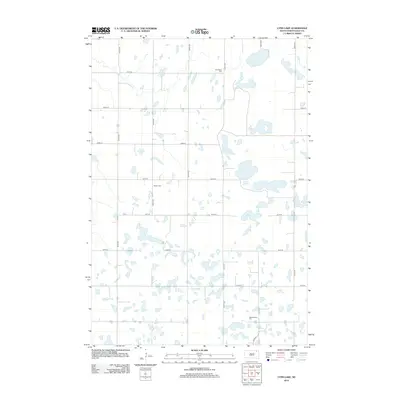
2012 Map of Lynn Lake
USGS Topo · Published 2012About this map
The glacial prairie landscape of Day County is defined by a dense network of seasonal wetlands and small basins, centered on the irregular shoreline of Lynn Lake. This 2012 survey documents a rural environment organized by a strict section-line road grid, including 426th Ave and 134th St, which connects isolated farmsteads across the undulating terrain. For genealogists, the map is particularly valuable for its precise location of three historic burial sites: Skudesnes Cem in the north, Bergen Cem near the center of the quadrangle, and New Sweden Cem to the south. These names reflect the Scandinavian heritage common to the region's homesteading era. The landscape remains largely agricultural, with natural drainage patterns and prairie potholes interspersed between the gravel roads and section lines.
Find a feature on this map
18 named features on this map. Tap any name to fly to it.
Don’t see what you’re looking for? This feature index may not catch every label — zoom into the map to look around manually.
Map Details
Editions of this 2012 Lynn Lake Map
This is the sole edition of this map. No revisions or reprints were ever made.
Other maps of this area

1953 · Milbank
USGS Topo · 1:250,000

1958 · Milbank
USGS Topo · 1:250,000

1958 · Britton 4 SW
USGS Topo · 1:24,000

1958 · Langford
USGS Topo · 1:24,000

1958 · Pierpont
USGS Topo · 1:24,000

1970 · Britton 4 SE
USGS Topo · 1:24,000

1973 · Lynn Lake
USGS Topo · 1:24,000

1973 · Webster
USGS Topo · 1:24,000

1973 · Bristol West
USGS Topo · 1:24,000

1973 · Bristol East
USGS Topo · 1:24,000