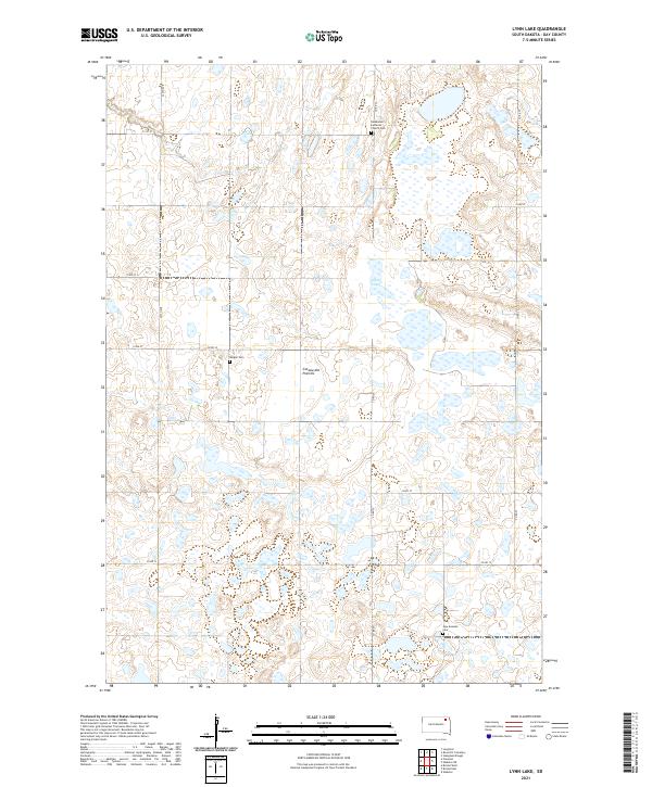
2021 Map of Lynn Lake
USGS Topo · Published 2021About this map
Coteau des Prairies defines the landscape of this region, where the high glacial plateau creates a complex network of wetlands and small water bodies. The terrain is dotted with markers of early Scandinavian settlement, most notably preserved at the Skudesnes Lutheran Church Cem in the north and the New Sweden Cem to the south. These sites, along with Bergen Cem, provide essential anchor points for genealogical research in this part of Day County. The rural infrastructure follows a rigid section-line grid, with routes like Co Rd 10 and 424th Ave cutting across the undulating ground. At the heart of the map lies Lynn Lake, one of several significant depressions in the plateau that collect drainage in this glaciated environment, reflecting the persistent prairie pothole character of the eastern Dakotas.
Find a feature on this map
20 named features on this map. Tap any name to fly to it.
Don’t see what you’re looking for? This feature index may not catch every label — zoom into the map to look around manually.
Map Details
Editions of this 2021 Lynn Lake Map
This is the sole edition of this map. No revisions or reprints were ever made.
Other maps of this area

1953 · Milbank
USGS Topo · 1:250,000

1958 · Milbank
USGS Topo · 1:250,000

1958 · Britton 4 SW
USGS Topo · 1:24,000

1958 · Langford
USGS Topo · 1:24,000

1958 · Pierpont
USGS Topo · 1:24,000

1970 · Britton 4 SE
USGS Topo · 1:24,000

1973 · Lynn Lake
USGS Topo · 1:24,000

1973 · Webster
USGS Topo · 1:24,000

1973 · Bristol West
USGS Topo · 1:24,000

1973 · Bristol East
USGS Topo · 1:24,000