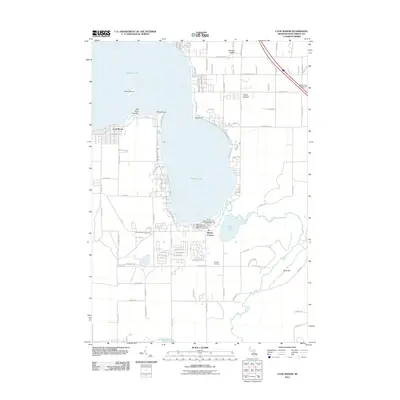
2011 Map of Lyon Manor
USGS Topo · Published 2011About this map
Higgins Lake dominates the landscape of this Roscommon County region, its western and southern shores densely lined with recreational properties and established communities. On the western shore, Lyon Manor stands out with its organized grid of streets including Pingree St and N Belgrade Rd, while the southern bank is defined by extensive state park facilities. The map traces the winding course of The Cut, a waterway connecting the basin of Marl Lake toward Houghton Lake to the south. Local heritage is preserved at the Gerrish Township Cemetery and Markey Cemetery. The layout of landmarks such as Old Point Comfort and Flag Point illustrates the long-standing appeal of the shoreline, supported by a network of seasonal and permanent settlements like Sharps Corners.
Find a feature on this map
83 named features on this map. Tap any name to fly to it.
Don’t see what you’re looking for? This feature index may not catch every label — zoom into the map to look around manually.
Map Details
Editions of this 2011 Lyon Manor Map
This is the sole edition of this map. No revisions or reprints were ever made.
Other maps of this area

1949 · Fletcher
USGS Topo · 1:62,500

1949 · Grayling
USGS Topo · 1:62,500

1950 · Cote Dame Marie
USGS Topo · 1:24,000

1950 · Roscommon North
USGS Topo · 1:24,000

1951 · Roscommon North
USGS Topo · 1:24,000

1951 · Pere Cheney
USGS Topo · 1:24,000

1954 · Traverse City
USGS Topo · 1:250,000

1956 · Houghton Lake
USGS Topo · 1:62,500

1958 · Traverse City
USGS Topo · 1:250,000

1963 · Roscommon South
USGS Topo · 1:24,000