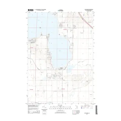
2014 Map of Lyon Manor
USGS Topo · Published 2014About this map
Higgins Lake dominates this northern Michigan landscape, providing a detailed look at the residential development and natural hydrology of Roscommon County in the early 21st century. The map highlights the established community of Lyon Manor and the smaller enclave at Sharps Corners, illustrating the concentration of local life along the southwestern shores. Significant local landmarks such as the Gerrish Township Cem and Markey Cem offer touchpoints for genealogists and local historians tracking family roots in the area. The water system is particularly intricate, showing the connection between lakes via The Cut, which flows through Marl Lake toward the northern reaches of Houghton Lake. Shoreline features like Old Point Comfort, Detroit Point, and Flag Point delineate the varied topography of the lakefront, while Flynn Island sits as a prominent landmark within the basin.
Find a feature on this map
100 named features on this map. Tap any name to fly to it.
Don’t see what you’re looking for? This feature index may not catch every label — zoom into the map to look around manually.
Map Details
Editions of this 2014 Lyon Manor Map
This is the sole edition of this map. No revisions or reprints were ever made.
Other maps of this area

1949 · Fletcher
USGS Topo · 1:62,500

1949 · Grayling
USGS Topo · 1:62,500

1950 · Cote Dame Marie
USGS Topo · 1:24,000

1950 · Roscommon North
USGS Topo · 1:24,000

1951 · Roscommon North
USGS Topo · 1:24,000

1951 · Pere Cheney
USGS Topo · 1:24,000

1954 · Traverse City
USGS Topo · 1:250,000

1956 · Houghton Lake
USGS Topo · 1:62,500

1958 · Traverse City
USGS Topo · 1:250,000

1963 · Roscommon South
USGS Topo · 1:24,000