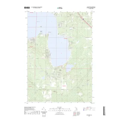
2023 Map of Lyon Manor
USGS Topo · Published 2023About this map
Higgins Lake dominates this northern Michigan landscape, where seasonal and permanent lakeside developments reflect decades of recreational growth. Along the eastern and southern shores, specific points like Old Point Comfort, Detroit Point, and Flag Point highlight early 20th-century settlement patterns. The map details the transition from high ground at Pioneer Ski Hill down to the low-lying wetlands of Lang Crossway Swamp and Marl Lake. Local history is anchored by the Gerrish Township Cem and Markey Cem, serving as important touchstones for genealogical research in Roscommon County. A dense network of local roads, such as W Burdell Rd and School Rd, intersects at Sharps Corners, illustrating the residential maturation of this popular vacation region.
Find a feature on this map
49 named features on this map. Tap any name to fly to it.
Don’t see what you’re looking for? This feature index may not catch every label — zoom into the map to look around manually.
Map Details
Editions of this 2023 Lyon Manor Map
This is the sole edition of this map. No revisions or reprints were ever made.
Other maps of this area

1949 · Fletcher
USGS Topo · 1:62,500

1949 · Grayling
USGS Topo · 1:62,500

1950 · Cote Dame Marie
USGS Topo · 1:24,000

1950 · Roscommon North
USGS Topo · 1:24,000

1951 · Roscommon North
USGS Topo · 1:24,000

1951 · Pere Cheney
USGS Topo · 1:24,000

1954 · Traverse City
USGS Topo · 1:250,000

1956 · Houghton Lake
USGS Topo · 1:62,500

1958 · Traverse City
USGS Topo · 1:250,000

1963 · Roscommon South
USGS Topo · 1:24,000