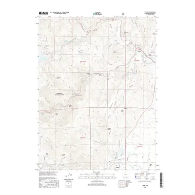
2016 Map of Lyons
USGS Topo · Published 2016About this map
Lyons serves as the gateway to the foothills, where the confluence of the north and south forks of the Saint Vrain Creek meets a sophisticated network of early water management infrastructure. The landscape is defined by the Saint Vrain Supply Tunnel and various irrigation channels like Highland Ditch, Toll Gate Ditch, and Table Mountain Ditch, which redirect snowmelt for the communities to the east. Further into the mountains, the Roosevelt National Forest protects major water stores at Button Rock Reservoir and Longmont Reservoir.
Find a feature on this map
88 named features on this map. Tap any name to fly to it.
Don’t see what you’re looking for? This feature index may not catch every label — zoom into the map to look around manually.
Map Details
Editions of this 2016 Lyons Map
This is the sole edition of this map. No revisions or reprints were ever made.
Other maps of this area

1902 · Boulder
USGS Topo · 1:62,500

1904 · Niwot
USGS Topo · 1:62,500

1904 · Boulder
USGS Topo · 1:62,500

1905 · Mount Olympus
USGS Topo · 1:62,500

1906 · Loveland
USGS Topo · 1:62,500

1907 · Mount Olympus
USGS Topo · 1:62,500

1908 · Loveland
USGS Topo · 1:62,500

1950 · Hygiene
USGS Topo · 1:24,000

1950 · Niwot
USGS Topo · 1:24,000
1951 · Niwot
USGS Topo · 1:24,000