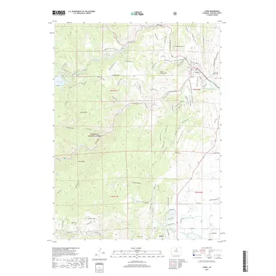
2019 Map of Lyons
USGS Topo · Published 2019About this map
Lyons sits at the confluence of the north and south forks of the N Saint Vrain Cr, serving as a critical gateway to the higher elevations of the Roosevelt National Forest. This 2019 survey illustrates the complex water management infrastructure supporting the region, including the Button Rock Reservoir, Longmont Reservoir, and the Saint Vrain Supply Tunnel. The landscape is defined by dramatic geological transitions, from the narrow passages of the Big Narrows and Little Narrows to prominent peaks like Steamboat Mtn and Fairview Peak.
Find a feature on this map
95 named features on this map. Tap any name to fly to it.
Don’t see what you’re looking for? This feature index may not catch every label — zoom into the map to look around manually.
Map Details
Editions of this 2019 Lyons Map
This is the sole edition of this map. No revisions or reprints were ever made.
Other maps of this area

1902 · Boulder
USGS Topo · 1:62,500

1904 · Niwot
USGS Topo · 1:62,500

1904 · Boulder
USGS Topo · 1:62,500

1905 · Mount Olympus
USGS Topo · 1:62,500

1906 · Loveland
USGS Topo · 1:62,500

1907 · Mount Olympus
USGS Topo · 1:62,500

1908 · Loveland
USGS Topo · 1:62,500

1950 · Hygiene
USGS Topo · 1:24,000

1950 · Niwot
USGS Topo · 1:24,000
1951 · Niwot
USGS Topo · 1:24,000