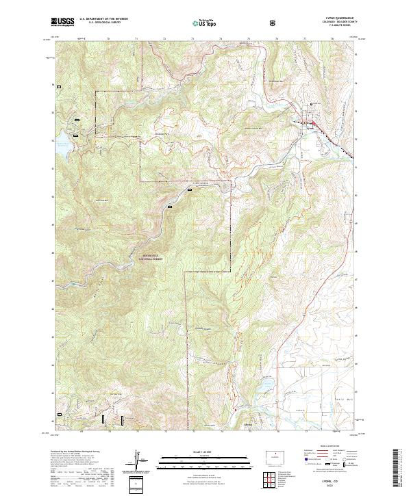
2022 Map of Lyons
USGS Topo · Published 2022About this map
The town of Lyons serves as the gateway to the foothills in this modern survey, where the N Saint Vrain Cr and S Saint Vrain Cr converge. The landscape is defined by its complex water management and high-relief terrain, featuring extensive irrigation works like the Table Mountain Ditch and Highland Ditch alongside significant impoundments such as Button Rock Reservoir and Longmont Reservoir. A network of trails including the Sleepy Lion Trl and Button Rock Trl highlights the area's transition into the Roosevelt National Forest. Geologic and historical markers are scattered throughout the peaks, from the Golden Age site in the southwest near Fairview Peak to the prominent heights of Steamboat Mtn and Coffintop Mtn. The settlement of Altona sits near the southern edge, connected to the local water systems by the Lake Ditch and Crocker Ditch.
Find a feature on this map
92 named features on this map. Tap any name to fly to it.
Don’t see what you’re looking for? This feature index may not catch every label — zoom into the map to look around manually.
Map Details
Editions of this 2022 Lyons Map
This is the sole edition of this map. No revisions or reprints were ever made.
Other maps of this area

1902 · Boulder
USGS Topo · 1:62,500

1904 · Niwot
USGS Topo · 1:62,500

1904 · Boulder
USGS Topo · 1:62,500

1905 · Mount Olympus
USGS Topo · 1:62,500

1906 · Loveland
USGS Topo · 1:62,500

1907 · Mount Olympus
USGS Topo · 1:62,500

1908 · Loveland
USGS Topo · 1:62,500

1950 · Hygiene
USGS Topo · 1:24,000

1950 · Niwot
USGS Topo · 1:24,000
1951 · Niwot
USGS Topo · 1:24,000