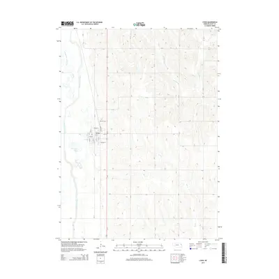
2014 Map of Lyons
USGS Topo · Published 2014About this map
Lyons serves as the central hub of this Burt County landscape, positioned where the grid of city streets like Main St and Pearl St meets the transit corridor of Us-77. The town's northern boundary is marked by Lyons Cem, accessible via Cemetery Rd. The geography here is defined by significant hydrological modification, most notably the Logan Creek Dredge which runs parallel to the meandering path of the Old Channel Logan Creek. To the east, the terrain rises into more complex drainages where S Blackbird Cr and Bell Cr carve through the agricultural uplands. This 2014 survey documents the enduring spatial relationship between the established townsite and the vital water management systems that shape the surrounding plains.
Find a feature on this map
34 named features on this map. Tap any name to fly to it.
Don’t see what you’re looking for? This feature index may not catch every label — zoom into the map to look around manually.
Map Details
Editions of this 2014 Lyons Map
This is the sole edition of this map. No revisions or reprints were ever made.
Other maps of this area

1955 · Sioux City
USGS Topo · 1:250,000

1955 · Fremont
USGS Topo · 1:250,000

1957 · Fremont
USGS Topo · 1:250,000

1958 · Sioux City
USGS Topo · 1:250,000

1958 · Fremont
USGS Topo · 1:250,000

1959 · Sioux City
USGS Topo · 1:250,000

1966 · Oakland
USGS Topo · 1:24,000

1966 · West Point SE
USGS Topo · 1:24,000

1966 · Lyons
USGS Topo · 1:24,000

1966 · West Point NE
USGS Topo · 1:24,000