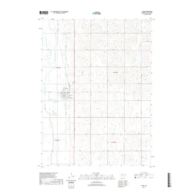
2017 Map of Lyons
USGS Topo · Published 2017About this map
Lyons serves as the central hub of this Burt County landscape, where the grid of city streets like Main St and Everett St meets the agricultural sections of the surrounding plains. The local geography is defined by the management of water, most notably the winding path of Old Channel Logan Creek and the straighter course of the Logan Creek Dredge, illustrating the long-term modification of the drainage system to support farming. To the north of the town center lies the Lyons Cem, a key landmark for genealogical research. The broader terrain is dissected by the tributaries of S Blackbird Cr and Bell Cr, with a dense network of section-line roads including Co Rd 11 and Co Rd U providing access to the various farmsteads and rural properties established across the township divisions of t23n r8e and t23n r9e.
Find a feature on this map
34 named features on this map. Tap any name to fly to it.
Don’t see what you’re looking for? This feature index may not catch every label — zoom into the map to look around manually.
Map Details
Editions of this 2017 Lyons Map
This is the sole edition of this map. No revisions or reprints were ever made.
Other maps of this area

1955 · Sioux City
USGS Topo · 1:250,000

1955 · Fremont
USGS Topo · 1:250,000

1957 · Fremont
USGS Topo · 1:250,000

1958 · Sioux City
USGS Topo · 1:250,000

1958 · Fremont
USGS Topo · 1:250,000

1959 · Sioux City
USGS Topo · 1:250,000

1966 · Oakland
USGS Topo · 1:24,000

1966 · West Point SE
USGS Topo · 1:24,000

1966 · Lyons
USGS Topo · 1:24,000

1966 · West Point NE
USGS Topo · 1:24,000