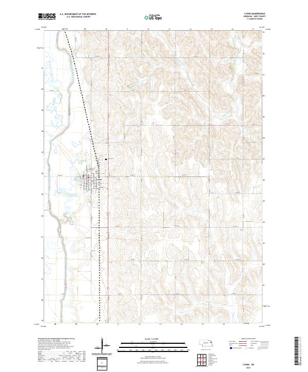
2021 Map of Lyons
USGS Topo · Published 2021About this map
Lyons serves as the central hub of this Burt County landscape, where a grid of streets like Main St and Diamond St defines the town's footprint. The surrounding terrain is heavily influenced by the management of local waterways, most notably the Logan Creek Dredge and the winding path of the Old Channel Logan Creek. This hydraulic engineering indicates a history of drainage and land reclamation for agriculture, a common theme in the fertile plains of Nebraska. To the north of the town center, Lyons Cem is reached via Cemetery Rd, while the broader township boundaries of t23n r8e and t23n r9e are marked by a regular network of county roads. The drainage systems of S Blackbird Cr and Bell Cr further delineate the area's topographic character, showing how the natural hydrology has been adapted for modern use.
Find a feature on this map
41 named features on this map. Tap any name to fly to it.
Don’t see what you’re looking for? This feature index may not catch every label — zoom into the map to look around manually.
Map Details
Editions of this 2021 Lyons Map
This is the sole edition of this map. No revisions or reprints were ever made.
Other maps of this area

1955 · Sioux City
USGS Topo · 1:250,000

1955 · Fremont
USGS Topo · 1:250,000

1957 · Fremont
USGS Topo · 1:250,000

1958 · Sioux City
USGS Topo · 1:250,000

1958 · Fremont
USGS Topo · 1:250,000

1959 · Sioux City
USGS Topo · 1:250,000

1966 · Oakland
USGS Topo · 1:24,000

1966 · West Point SE
USGS Topo · 1:24,000

1966 · Lyons
USGS Topo · 1:24,000

1966 · West Point NE
USGS Topo · 1:24,000