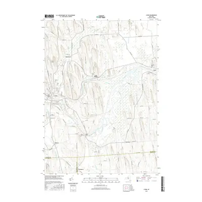
2016 Map of Lyons
USGS Topo · Published 2016About this map
The Clyde River and the Old Erie Canal define the corridor of transit and settlement through this portion of New York, where the historic canal path runs roughly parallel to the river's winding course. The village of Lyons serves as a focal point where the Canandaigua Outlet joins the river system, marked by the Leach Street Bridge. This area is dense with genealogical markers, from the Old Clyde Village Cem to the Creager Bridge Cem near Alloway. Smaller settlements like Lock Berlin, Pilgrimport, and Marengo are scattered across a landscape shaped by glacial drumlins and wet lowlands like those surrounding Black Brook. To the south, the terrain descends toward the boundary of Wayne and Ontario Counties, passing through the hamlet of Thompson and the marshy reaches of Dublin Brook.
Find a feature on this map
99 named features on this map. Tap any name to fly to it.
Don’t see what you’re looking for? This feature index may not catch every label — zoom into the map to look around manually.
Map Details
Editions of this 2016 Lyons Map
This is the sole edition of this map. No revisions or reprints were ever made.
Other maps of this area

1899 · Palmyra
USGS Topo · 1:62,500

1902 · Geneva
USGS Topo · 1:62,500

1902 · Clyde
USGS Topo · 1:62,500

1902 · Phelps
USGS Topo · 1:62,500

1902 · Palmyra
USGS Topo · 1:62,500

1943 · Lyons
USGS Topo · 1:31,680

1943 · Geneva North
USGS Topo · 1:31,680

1943 · Phelps
USGS Topo · 1:31,680

1943 · Savannah
USGS Topo · 1:31,680

1943 · Sodus
USGS Topo · 1:31,680