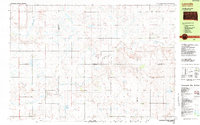
1982 Map of Lyonville
USGS Topo · Published 1983About this map
Lyonville serves as the small hub of this agricultural landscape in the early 1980s, where the boundaries of Buffalo, Jerauld, Brule, and Aurora counties meet. The map reveals a community organized around rural infrastructure, featuring the Lyon Sch and churches like Crow Lake Ch. The terrain is defined by a network of drainage systems including Crow Creek, Smith Creek, and Sayles Creek, which carve through the plains and feed into local water bodies such as Jones Lake and Ishum Lake. Local history is anchored by the Salem Cem in the north and Pleasant Hill Cem near the center, marking the multigenerational footprint of the families who settled these townships. The presence of a Gravel Pit and several Radio Towers indicates the modest industrial and communication needs of the area during this era.
Find a feature on this map
23 named features on this map. Tap any name to fly to it.
Don’t see what you’re looking for? This feature index may not catch every label — zoom into the map to look around manually.
Map Details
Editions of this 1982 Lyonville Map
This is the sole edition of this map. No revisions or reprints were ever made.
Other maps of this area

1941 · Pukwana
USGS Topo · 1:62,500

1941 · Kimball North
USGS Topo · 1:62,500

1942 · Crow Lake
USGS Topo · 1:62,500

1951 · Pukwana
USGS Topo · 1:62,500

1951 · Kimball North
USGS Topo · 1:62,500

1953 · Huron
USGS Topo · 1:250,000

1954 · Huron
USGS Topo · 1:250,000

1955 · Mitchell
USGS Topo · 1:250,000

1959 · Mitchell
USGS Topo · 1:250,000

1973 · Big Bend Dam 4 SE
USGS Topo · 1:24,000