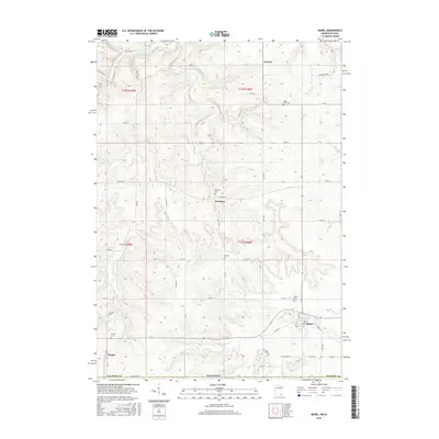
2016 Map of Mabel
USGS Topo · Published 2016About this map
Mabel and the surrounding Fillmore County countryside are defined by a network of dendritic drainage patterns and rural crossroads at the Minnesota-Iowa border. This landscape is marked by the presence of numerous small community burial grounds, such as North Sheie Cem, Newburg Cem, and Garness Cem, which reflect the localized settlement history of the region. The drainage is dominated by the S Fork Root River in the north and the winding Riceford Cr to the south. Small hamlets like Newburg and Tawney sit alongside a grid of early county roads, including Co Hwy 24 and Co Hwy 28, while Prosper anchors the southwestern corner. The area demonstrates a classic Midwestern agricultural layout where small towns emerged at regular intervals to serve the surrounding farmstead populations.
Find a feature on this map
38 named features on this map. Tap any name to fly to it.
Don’t see what you’re looking for? This feature index may not catch every label — zoom into the map to look around manually.
Map Details
Editions of this 2016 Mabel Map
This is the sole edition of this map. No revisions or reprints were ever made.
Other maps of this area

1906 · Decorah
USGS Topo · 1:125,000

1958 · La Crosse
USGS Topo · 1:250,000

1961 · La Crosse
USGS Topo · 1:250,000

1965 · La Crosse
USGS Topo · 1:250,000

1965 · Mabel
USGS Topo · 1:24,000

1965 · Spring Grove
USGS Topo · 1:24,000

1965 · Canton
USGS Topo · 1:24,000

1965 · Yucatan
USGS Topo · 1:24,000

1965 · Bratsberg
USGS Topo · 1:24,000
1965 · Lanesboro
USGS Topo · 1:24,000