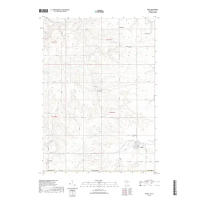
2019 Map of Mabel
USGS Topo · Published 2019About this map
Mabel and the surrounding farmland of southern Fillmore County are defined by a complex network of waterways carving through the landscape just north of the Iowa border. The drainage patterns of Riceford Cr and Wisel Cr illustrate the deeply dissected terrain of the driftless area, where small settlements like Newburg and Prosper are established along high ridges and valley floors. This survey documents a rural environment where local history is anchored by numerous community burial sites, including North Sheie Cem, Garness Cem, and Newburg Cem. The northern edge of the map features the S Fork Root River, a primary watercourse that historically shaped the regional topography. The grid of country roads, such as Co HWY 24 and State Line RD, connects these isolated communities, reflecting a century of agricultural development in this corner of Minnesota.
Find a feature on this map
50 named features on this map. Tap any name to fly to it.
Don’t see what you’re looking for? This feature index may not catch every label — zoom into the map to look around manually.
Map Details
Editions of this 2019 Mabel Map
This is the sole edition of this map. No revisions or reprints were ever made.
Other maps of this area

1906 · Decorah
USGS Topo · 1:125,000

1958 · La Crosse
USGS Topo · 1:250,000

1961 · La Crosse
USGS Topo · 1:250,000

1965 · La Crosse
USGS Topo · 1:250,000

1965 · Mabel
USGS Topo · 1:24,000

1965 · Spring Grove
USGS Topo · 1:24,000

1965 · Canton
USGS Topo · 1:24,000

1965 · Yucatan
USGS Topo · 1:24,000

1965 · Bratsberg
USGS Topo · 1:24,000
1965 · Lanesboro
USGS Topo · 1:24,000