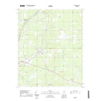
2020 Map of Maben
USGS Topo · Published 2020About this map
Maben and Mathiston serve as the primary hubs on this 2020 survey, situated at the junction where Webster, Choctaw, and Oktibbeha counties meet. This modern topographic record captures the intersection of traditional rural routes and significant throughways like the Natchez Trace Parkway, which winds through the northwest corner near Cumberland. The landscape is defined by its intricate drainage networks, with Pigeon Roost Cr and Sun Cr cutting through the lowlands south of the railroad corridors. For those tracing local heritage, the map identifies several distinct burial grounds, including the Spring Valley Cem and Clear Springs Cem, alongside recreational features like Lake Tuckaway. The density of named local roads, such as Parker Roberson Rd and Nason Rd, provides a precise framework for locating family lands and historic homestead sites in this tri-county region.
Find a feature on this map
108 named features on this map. Tap any name to fly to it.
Don’t see what you’re looking for? This feature index may not catch every label — zoom into the map to look around manually.
Map Details
Editions of this 2020 Maben Map
This is the sole edition of this map. No revisions or reprints were ever made.
Other maps of this area

1953 · West Point
USGS Topo · 1:250,000

1958 · West Point
USGS Topo · 1:250,000

1959 · Pheba
USGS Topo · 1:62,500

1963 · West Point
USGS Topo · 1:250,000

1965 · Longview
USGS Topo · 1:24,000

1972 · Maben
USGS Topo · 1:24,000

1972 · Sapa
USGS Topo · 1:24,000

1972 · Hohenlinden
USGS Topo · 1:24,000

1972 · Mantee
USGS Topo · 1:24,000

1972 · Double Springs
USGS Topo · 1:24,000