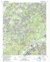
1992 Map of Mableton
USGS Topo · Published 1992About this map
Mableton and Austell serve as central hubs in this early 1990s landscape, where suburban growth meets the industrial and transport corridors of western Georgia. The Chattahoochee River and Sweetwater Creek define the southern terrain, with the Sweetwater Creek State Park preserved along the banks. This era shows the heavy influence of rail and air infrastructure, featuring the extensive yards of the Southern Railway and the County Airport (Browns Field) near Howells.
Find a feature on this map
81 named features on this map. Tap any name to fly to it.
Don’t see what you’re looking for? This feature index may not catch every label — zoom into the map to look around manually.
Map Details
Editions of this 1992 Mableton Map
2 editions found
Other maps of this area

1888 · Atlanta
USGS Topo · 1:125,000

1890 · Atlanta
USGS Topo · 1:125,000

1891 · Marietta
USGS Topo · 1:125,000

1892 · Atlanta
USGS Topo · 1:125,000

1895 · Atlanta
USGS Topo · 1:125,000

1895 · Marietta
USGS Topo · 1:125,000

1897 · Marietta
USGS Topo · 1:125,000

1901 · Marietta
USGS Topo · 1:125,000

1953 · Atlanta
USGS Topo · 1:250,000

1954 · Campbellton
USGS Topo · 1:24,000