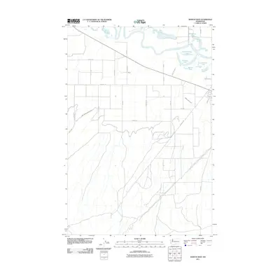
2011 Map of Mabton West
USGS Topo · Published 2011About this map
The Yakima River meanders across the northern portion of this Yakima County landscape, creating a complex system of backwaters and oxbow lakes. Numerous small bodies of water, including Slaughterhouse Lake, Horseshoe Lake, and Warren Lake, dot the river valley, indicating the dynamic nature of the waterway's flood plain. The settlement of Empire sits at the intersection of Bond Rd and Florence Rd, serving as a central point in an extensive grid of agricultural transit routes such as Speedis Rd and Switzler Rd.
Find a feature on this map
33 named features on this map. Tap any name to fly to it.
Don’t see what you’re looking for? This feature index may not catch every label — zoom into the map to look around manually.
Map Details
Editions of this 2011 Mabton West Map
This is the sole edition of this map. No revisions or reprints were ever made.
Other maps of this area

1910 · Zillah
USGS Topo · 1:125,000

1915 · Prosser
USGS Topo · 1:125,000

1917 · Prosser
USGS Topo · 1:125,000

1950 · Yakima
USGS Topo · 1:250,000

1950 · Grandview
USGS Topo · 1:62,500

1951 · Grandview
USGS Topo · 1:62,500

1953 · Walla Walla
USGS Topo · 1:250,000

1955 · Prosser SW
USGS Topo · 1:24,000

1958 · Walla Walla
USGS Topo · 1:250,000

1958 · Yakima
USGS Topo · 1:250,000