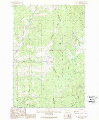
1989 Map of Mac Donald Pass
USGS Topo · Published 1989About this map
Frontier Town sits along the Continental Divide in this late-century survey of the high mountain passage between Powell and Lewis and Clark Counties. The landscape is defined by its transit history and extractive roots, featuring the prominent MacDonald Pass and Priest Pass. These corridors have long served as vital crossings for both infrastructure and industry, evidenced by the numerous Prospect locations and mining operations like the Third Term Mine found tucked into the gulches.
Find a feature on this map
41 named features on this map. Tap any name to fly to it.
Don’t see what you’re looking for? This feature index may not catch every label — zoom into the map to look around manually.
Map Details
Editions of this 1989 Mac Donald Pass Map
2 editions found
Other maps of this area

1889 · Helena
USGS Topo · 1:250,000

1893 · Helena
USGS Topo · 1:250,000

1899 · Boulder
USGS Topo · 1:125,000

1899 · Helena
USGS Topo · 1:250,000

1903 · Helena
USGS Topo · 1:250,000

1947 · Butte
USGS Topo · 1:250,000

1950 · Jefferson City
USGS Topo · 1:62,500

1950 · Helena
USGS Topo · 1:62,500

1954 · Basin
USGS Topo · 1:62,500

1958 · Butte
USGS Topo · 1:250,000