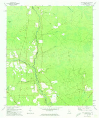
1972 Map of Macclenny NW
USGS Topo · Published 1973About this map
The St Marys River winds along the border of Georgia and Florida, anchoring a landscape defined by expansive wetlands and timberlands in the early 1970s. The area is characterized by a low-lying, watery geography where Whites Flat Bay and Moccasin Bay meet a network of tributaries including Middle Prong and North Prong. Small rural centers are identified by their community landmarks, such as Baxter Ch, Moniac Ch, and the Taylor Sch. The southwestern portion of the sheet is dominated by the protected acreage of the Osceola National Forest. The map captures a quiet, rural era where travel was largely facilitated by a grid of unimproved roads and a labeled Base Line, showing the sparse settlement patterns typical of this border region before further modern development.
Find a feature on this map
24 named features on this map. Tap any name to fly to it.
Don’t see what you’re looking for? This feature index may not catch every label — zoom into the map to look around manually.
Map Details
Editions of this 1972 Macclenny NW Map
2 editions found
Other maps of this area

1917 · Macclenny
USGS Topo · 1:62,500

1918 · Moniac
USGS Topo · 1:62,500

1918 · Macclenny
USGS Topo · 1:62,500

1942 · Moniac
USGS Topo · 1:62,500

1954 · Valdosta
USGS Topo · 1:250,000

1956 · Eddy
USGS Topo · 1:24,000

1958 · Valdosta
USGS Topo · 1:250,000

1959 · Valdosta
USGS Topo · 1:250,000
1966 · St George
USGS Topo · 1:24,000
1967 · Moniac
USGS Topo · 1:24,000