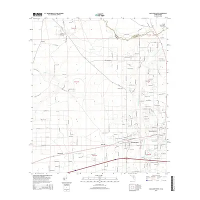
2015 Map of Macclenny West
USGS Topo · Published 2015About this map
Macclenny and the nearby community of Glen Saint Mary anchor this survey of Baker County, Florida, where the S Prong Saint Marys River meanders northward toward the state line. The landscape is defined by the winding course of the Saint Marys River, including the prominent geographical feature known as The Big Bend of Saint Marys River at the boundary with Georgia. This 2015 data shows a mix of established residential patterns and agricultural tracts, with smaller settlements like Margaretta and Kenny situated along the rural road network.
Find a feature on this map
168 named features on this map. Tap any name to fly to it.
Don’t see what you’re looking for? This feature index may not catch every label — zoom into the map to look around manually.
Map Details
Editions of this 2015 Macclenny West Map
This is the sole edition of this map. No revisions or reprints were ever made.
Other maps of this area

1917 · Macclenny
USGS Topo · 1:62,500

1918 · Lawtey
USGS Topo · 1:62,500

1918 · Macclenny
USGS Topo · 1:62,500

1954 · Valdosta
USGS Topo · 1:250,000

1958 · Valdosta
USGS Topo · 1:250,000

1959 · Valdosta
USGS Topo · 1:250,000

1963 · Sanderson South
USGS Topo · 1:24,000

1969 · Sanderson North
USGS Topo · 1:24,000
1969 · Taylor
USGS Topo · 1:24,000
1970 · Manning
USGS Topo · 1:24,000