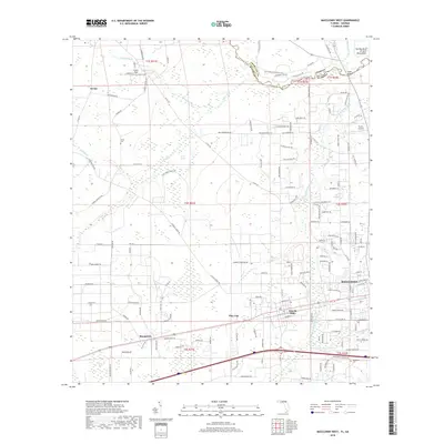
2018 Map of Macclenny West
USGS Topo · Published 2018About this map
The Saint Marys River carves a meandering boundary between Florida and Georgia at the northern edge of this landscape, notably creating The Big Bend of Saint Marys River. The western outskirts of Macclenny serve as the primary developed hub, giving way to a network of rural roads named for local families and landmarks. Significant aviation sites including Cuyler Field and Thrifts Airport are situated north of the Interstate 10 corridor, which bisects the southern half of the quadrangle.
Find a feature on this map
182 named features on this map. Tap any name to fly to it.
Don’t see what you’re looking for? This feature index may not catch every label — zoom into the map to look around manually.
Map Details
Editions of this 2018 Macclenny West Map
This is the sole edition of this map. No revisions or reprints were ever made.
Other maps of this area

1917 · Macclenny
USGS Topo · 1:62,500

1918 · Lawtey
USGS Topo · 1:62,500

1918 · Macclenny
USGS Topo · 1:62,500

1954 · Valdosta
USGS Topo · 1:250,000

1958 · Valdosta
USGS Topo · 1:250,000

1959 · Valdosta
USGS Topo · 1:250,000

1963 · Sanderson South
USGS Topo · 1:24,000

1969 · Sanderson North
USGS Topo · 1:24,000
1969 · Taylor
USGS Topo · 1:24,000
1970 · Manning
USGS Topo · 1:24,000