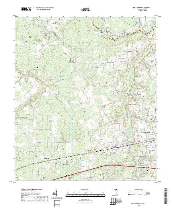
2024 Map of Macclenny West
USGS Topo · Published 2024About this map
The Saint Marys River winds along the border between Florida and Georgia, defining the northern landscape of this Baker County region. The western outskirts of Macclenny and the town of Glen St. Mary serve as primary population centers, connected by the active line of CSX Transportation and several rural thoroughfares. Further south, the map identifies smaller settlements such as Margaretta and Kenny, alongside local landmarks like Cuyler Field and Thrifts Airport.
Find a feature on this map
163 named features on this map. Tap any name to fly to it.
Don’t see what you’re looking for? This feature index may not catch every label — zoom into the map to look around manually.
Map Details
Editions of this 2024 Macclenny West Map
This is the sole edition of this map. No revisions or reprints were ever made.
Other maps of this area

1917 · Macclenny
USGS Topo · 1:62,500

1918 · Lawtey
USGS Topo · 1:62,500

1918 · Macclenny
USGS Topo · 1:62,500

1954 · Valdosta
USGS Topo · 1:250,000

1958 · Valdosta
USGS Topo · 1:250,000

1959 · Valdosta
USGS Topo · 1:250,000

1963 · Sanderson South
USGS Topo · 1:24,000

1969 · Sanderson North
USGS Topo · 1:24,000
1969 · Taylor
USGS Topo · 1:24,000
1970 · Manning
USGS Topo · 1:24,000