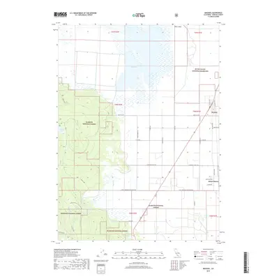
2018 Map of MacDoel
USGS Topo · Published 2018About this map
Butte Valley dominates the eastern half of this Siskiyou County landscape, defined by a distinct grid of agricultural roads and the primary settlements of Macdoel and Mount Hebron. The valley floor is punctuated by the expansive and seasonally fluctuating Meiss Lake, surrounded by drainage networks like Prather Cr and the ephemeral Mud Lake. This area reflects a highly organized land-use pattern, where straight-line thoroughfares such as Meiss Lake Rd and W Macdoel District Rd partition the fertile flats between federal lands.
Find a feature on this map
41 named features on this map. Tap any name to fly to it.
Don’t see what you’re looking for? This feature index may not catch every label — zoom into the map to look around manually.
Map Details
Editions of this 2018 MacDoel Map
This is the sole edition of this map. No revisions or reprints were ever made.
Other maps of this area

1886 · Modoc Lava Bed
USGS Topo · 1:250,000

1886 · Shasta
USGS Topo · 1:250,000

1892 · Modoc Lava-Bed
USGS Topo · 1:250,000

1894 · Shasta
USGS Topo · 1:250,000

1934 · Macdoel
USGS Topo · 1:96,000

1941 · Macdoel
USGS Topo · 1:125,000

1948 · Weed
USGS Topo · 1:250,000

1950 · Weed
USGS Topo · 1:250,000

1950 · Bray
USGS Topo · 1:62,500

1950 · Dorris
USGS Topo · 1:62,500