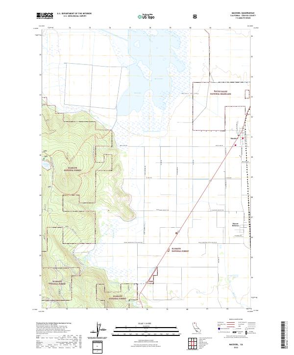
2022 Map of MacDoel
USGS Topo · Published 2022About this map
The Butte Valley basin dominates this landscape in northern California, characterized by the expansive wetlands of Meiss Lake and the agricultural grid of the Butte Valley National Grassland. The small settlements of Macdoel and Mount Hebron serve as the primary hubs along the Old State Hwy, situated near the eastern edge of the quadrangle. To the west, the terrain rises sharply into the Klamath National Forest, where high-altitude water features like Juanita Lake and Smith Springs are accessible via a network of forest routes and trails, including the Juanita Lake Trl and Long Loop Trl. This geography illustrates a sharp transition between the irrigated valley floor and the timbered slopes of the southern Cascades region, where drainage from Prather Cr and Butte Cr feeds the valley's hydrologic system.
Find a feature on this map
44 named features on this map. Tap any name to fly to it.
Don’t see what you’re looking for? This feature index may not catch every label — zoom into the map to look around manually.
Map Details
Editions of this 2022 MacDoel Map
This is the sole edition of this map. No revisions or reprints were ever made.
Other maps of this area

1886 · Modoc Lava Bed
USGS Topo · 1:250,000

1886 · Shasta
USGS Topo · 1:250,000

1892 · Modoc Lava-Bed
USGS Topo · 1:250,000

1894 · Shasta
USGS Topo · 1:250,000

1934 · Macdoel
USGS Topo · 1:96,000

1941 · Macdoel
USGS Topo · 1:125,000

1948 · Weed
USGS Topo · 1:250,000

1950 · Weed
USGS Topo · 1:250,000

1950 · Bray
USGS Topo · 1:62,500

1950 · Dorris
USGS Topo · 1:62,500