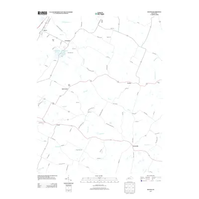
2013 Map of Maceo
USGS Topo · Published 2013About this map
Maceo and the surrounding rural landscape of northeastern Daviess County appear here in detail, defined by a complex network of agricultural drainage and small rural settlements. Historically significant locations like Yelvington and Knottsville serve as anchors for a region where family lineage is preserved in numerous small burial grounds, including the Hawes-Taylor Cem and Winkler Cem. The terrain is marked by distinct elevations such as Spice Knob and Iron Ore Hill, while the lowlands are managed through an extensive system of waterways like Hazel Ditch and Allgood Ditch. Recreation and local geography converge at Carpenters Lake and the Kingfisher Lakes, which provide a contrast to the surrounding creek-cut topography of Pup Cr and Little Blackford Cr. This survey documents the modern road network, from Old Highway 144 to the many lanes connecting outlying farms to the primary community centers.
Find a feature on this map
87 named features on this map. Tap any name to fly to it.
Don’t see what you’re looking for? This feature index may not catch every label — zoom into the map to look around manually.
Map Details
Editions of this 2013 Maceo Map
This is the sole edition of this map. No revisions or reprints were ever made.
Other maps of this area

1901 · Owensboro
USGS Topo · 1:62,500

1903 · Tell City
USGS Topo · 1:62,500

1906 · Sutherland
USGS Topo · 1:62,500

1907 · Whitesville
USGS Topo · 1:62,500

1909 · Whitesville
USGS Topo · 1:62,500

1952 · Owensboro East
USGS Topo · 1:24,000

1952 · Rockport
USGS Topo · 1:24,000

1953 · Philpot
USGS Topo · 1:24,000

1953 · Sutherland
USGS Topo · 1:24,000

1953 · Lewisport
USGS Topo · 1:24,000