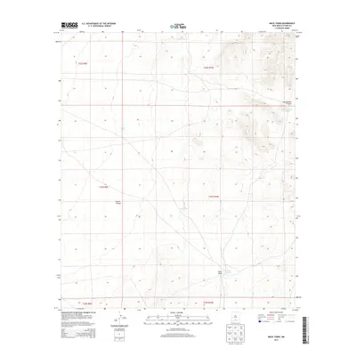
2013 Map of Mack Tanks
USGS Topo · Published 2013About this map
Little Mack Tank and several other man-made water catchments define this arid landscape in southern New Mexico. This 2013 survey documents a remote section of the Otero Mesa, where the topography transitions from the high plains into the dramatic relief of Hay Meadow Canyon. The map reveals a land managed for water resources, with features like Middle Tank and Little Crockett Tank strategically placed to capture runoff. The drainage network is anchored by Mack Draw in the south, while Martin Canyon cuts through the central western sections. These landmarks, often associated with historic ranching operations, serve as vital navigational points in a region defined by its wide-open spaces and complex desert hydrology.
Find a feature on this map
14 named features on this map. Tap any name to fly to it.
Don’t see what you’re looking for? This feature index may not catch every label — zoom into the map to look around manually.
Map Details
Editions of this 2013 Mack Tanks Map
This is the sole edition of this map. No revisions or reprints were ever made.
Other maps of this area

1940 · Bassett Lake
USGS Topo · 1:62,500

1940 · Orogrande
USGS Topo · 1:62,500

1941 · Desert
USGS Topo · 1:62,500

1943 · Pendejo Wash
USGS Topo · 1:62,500

1943 · Desert
USGS Topo · 1:62,500

1943 · Bassett Lake
USGS Topo · 1:62,500

1943 · Orogrande
USGS Topo · 1:62,500

1947 · Desert NE
USGS Topo · 1:24,000

1947 · Orogrande North
USGS Topo · 1:24,000
1948 · Orogrande South
USGS Topo · 1:24,000