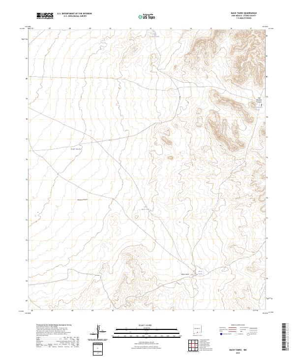
2023 Map of Mack Tanks
USGS Topo · Published 2023About this map
Fort Bliss dominates the western portion of this Otero County landscape, situated within a vast stretch of arid terrain defined by isolated water catchments and relief drainage. The area's reliance on managed water sources is evident through the placement of Mack Tanks, Little Mack Tank, and Little Crockett Tank, which serve as critical landmarks in a region largely devoid of permanent natural surface water. These features are positioned strategically relative to the topographic draws and canyons that channel seasonal runoff, such as Mack Draw.
Find a feature on this map
14 named features on this map. Tap any name to fly to it.
Don’t see what you’re looking for? This feature index may not catch every label — zoom into the map to look around manually.
Map Details
Editions of this 2023 Mack Tanks Map
This is the sole edition of this map. No revisions or reprints were ever made.
Other maps of this area

1940 · Bassett Lake
USGS Topo · 1:62,500

1940 · Orogrande
USGS Topo · 1:62,500

1941 · Desert
USGS Topo · 1:62,500

1943 · Pendejo Wash
USGS Topo · 1:62,500

1943 · Desert
USGS Topo · 1:62,500

1943 · Bassett Lake
USGS Topo · 1:62,500

1943 · Orogrande
USGS Topo · 1:62,500

1947 · Desert NE
USGS Topo · 1:24,000

1947 · Orogrande North
USGS Topo · 1:24,000
1948 · Orogrande South
USGS Topo · 1:24,000