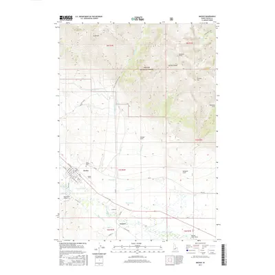
2017 Map of Mackay
USGS Topo · Published 2017About this map
Mackay and the settlement of Houston anchor this Custer County landscape where high mountain peaks meet the agricultural infrastructure of the Big Lost River Valley. The town of Mackay is meticulously detailed, showing the street grid from Salmon St down to Smelter Ave, while the Mount McCaleb Cem sits at the foot of the soaring Mt McCaleb. This 2017 edition illustrates a complex system of water management essential to the high desert, including the Lower Cedar Cr Ditch, Nielsen Ditch, and Sharp Ditch. These man-made channels diverge from the Big Lost River to irrigate the flatlands, transitioning into the protected wilderness of the Challis National Forest. Notable landmarks such as the Mackay Airport and the geological formation of Invisible Mtn define the periphery of this mountain-locked valley.
Find a feature on this map
54 named features on this map. Tap any name to fly to it.
Don’t see what you’re looking for? This feature index may not catch every label — zoom into the map to look around manually.
Map Details
Editions of this 2017 Mackay Map
This is the sole edition of this map. No revisions or reprints were ever made.
Other maps of this area

1935 · MacKay
USGS Topo · 1:96,000

1935 · Borah Peak
USGS Topo · 1:125,000

1938 · Borah Peak
USGS Topo · 1:125,000

1940 · Mackay
USGS Topo · 1:62,500

1955 · Dubois
USGS Topo · 1:250,000

1955 · Idaho Falls
USGS Topo · 1:250,000

1957 · Hawley Mountain
USGS Topo · 1:62,500

1958 · Dubois
USGS Topo · 1:250,000

1958 · Idaho Falls
USGS Topo · 1:250,000

1960 · Mackay
USGS Topo · 1:62,500