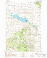
1991 Map of Mackay Reservoir
USGS Topo · Published 1991About this map
The Mackay Reservoir serves as the central focal point of this Custer County landscape, held by the Mackay Dam along the course of the Big Lost River. The terrain transitions from the alluvial Cedar Creek Bar in the north to the industrial activity of the southern peaks. Within the White Knob Mountains, an extensive mining history is evident through concentrated excavations and named shafts. The presence of the Empire Mine, Cossack Tunnel, and Darlington Shaft suggests a period of significant extraction in the hills above Rio Grande Canyon. Cultural landmarks include the Battleground Cem near the reservoir's northern reach and several gaging stations monitoring the river's flow through the Challis National Forest. Local irrigation and drainage are detailed by features like the Nielsen Ditch and Sharp Ditch as the water travels southeast toward Swauger Slough.
Find a feature on this map
58 named features on this map. Tap any name to fly to it.
Don’t see what you’re looking for? This feature index may not catch every label — zoom into the map to look around manually.
Map Details
Editions of this 1991 Mackay Reservoir Map
This is the sole edition of this map. No revisions or reprints were ever made.
Other maps of this area

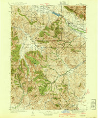
1935 · MacKay
USGS Topo · 1:96,000

1935 · Borah Peak
USGS Topo · 1:125,000

1938 · Borah Peak
USGS Topo · 1:125,000
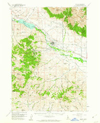
1940 · Mackay
USGS Topo · 1:62,500

1955 · Dubois
USGS Topo · 1:250,000

1955 · Idaho Falls
USGS Topo · 1:250,000

1958 · Dubois
USGS Topo · 1:250,000

1958 · Idaho Falls
USGS Topo · 1:250,000
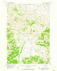
1960 · Mackay
USGS Topo · 1:62,500
1960 · Copper Basin
USGS Topo · 1:62,500