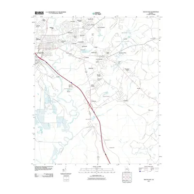
2011 Map of Macon East
USGS Topo · Published 2011About this map
Ocmulgee National Monument and the prehistoric Lamar Mounds define the landscape east of the Ocmulgee River in this detailed 2011 survey. The terrain is a mix of residential expansion and preserved history, where established neighborhoods like Shirlington, Cross Keys, and East Macon sit alongside significant local landmarks. The map documents a dense network of water features including the Lakeside Reservoir, Swift Creek, and Stone Lake, which are integral to the area's geography.
Find a feature on this map
99 named features on this map. Tap any name to fly to it.
Don’t see what you’re looking for? This feature index may not catch every label — zoom into the map to look around manually.
Map Details
Editions of this 2011 Macon East Map
This is the sole edition of this map. No revisions or reprints were ever made.
Other maps of this area

1956 · Gordon
USGS Topo · 1:62,500

1956 · Warner Robins
USGS Topo · 1:62,500

1956 · Jeffersonville
USGS Topo · 1:62,500

1956 · Macon West
USGS Topo · 1:24,000

1956 · Macon East
USGS Topo · 1:24,000

1956 · Macon
USGS Topo · 1:62,500

1957 · Macon
USGS Topo · 1:250,000

1958 · Macon
USGS Topo · 1:250,000

1964 · Macon
USGS Topo · 1:250,000
1973 · Macon NE
USGS Topo · 1:24,000