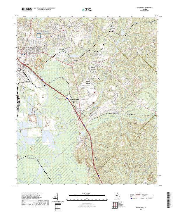
2024 Map of Macon East
USGS Topo · Published 2024About this map
The Ocmulgee National Monument preserves a complex landscape of earthworks and ceremonial mounds along the eastern banks of the Ocmulgee River, just across from the urban reach of Macon. This modern survey details the transition from the city's industrial and transportation hubs, including the Macon Downtown Airport and various residential developments like Cross Keys and Wheeler Heights, into the protected wetlands of the south.
Find a feature on this map
173 named features on this map. Tap any name to fly to it.
Don’t see what you’re looking for? This feature index may not catch every label — zoom into the map to look around manually.
Map Details
Editions of this 2024 Macon East Map
This is the sole edition of this map. No revisions or reprints were ever made.
Other maps of this area

1956 · Gordon
USGS Topo · 1:62,500

1956 · Warner Robins
USGS Topo · 1:62,500

1956 · Jeffersonville
USGS Topo · 1:62,500

1956 · Macon West
USGS Topo · 1:24,000

1956 · Macon East
USGS Topo · 1:24,000

1956 · Macon
USGS Topo · 1:62,500

1957 · Macon
USGS Topo · 1:250,000

1958 · Macon
USGS Topo · 1:250,000

1964 · Macon
USGS Topo · 1:250,000
1973 · Macon NE
USGS Topo · 1:24,000