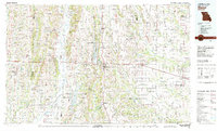
1981 Map of Macon
USGS Topo · Published 1981About this map
Macon serves as the central hub of this northern Missouri landscape during the early 1980s, situated at the crossroads of US Highway 36 and US Highway 63. The region is defined by a extensive network of waterways, including the Chariton River to the west and the North Fork Salt River and South Fork Salt River to the east. The 1981 data highlights significant water management projects like Long Branch Reservoir and Thomas Hill State Reservoir, which altered the drainage of the East Fork Chariton River.
Find a feature on this map
139 named features on this map. Tap any name to fly to it.
Don’t see what you’re looking for? This feature index may not catch every label — zoom into the map to look around manually.
Map Details
Editions of this 1981 Macon Map
This is the sole edition of this map. No revisions or reprints were ever made.
Other maps of this area

1890 · Mexico
USGS Topo · 1:125,000

1890 · Moberly
USGS Topo · 1:125,000

1890 · Glasgow
USGS Topo · 1:125,000

1890 · Marshall
USGS Topo · 1:125,000

1892 · Marshall
USGS Topo · 1:125,000

1901 · Marshall
USGS Topo · 1:125,000

1903 · Kahoka
USGS Topo · 1:125,000

1903 · Palmyra
USGS Topo · 1:125,000

1903 · Edina
USGS Topo · 1:125,000

1908 · Atlanta
USGS Topo · 1:62,500