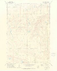
1973 Map of Macs Corner
USGS Topo · Published 1976About this map
Macs Corner stands as the primary namesake for this rural landscape in Hyde County, where the topography transitions into the Crow Creek Indian Reservation. The map details a network of early 1970s section roads and small-scale infrastructure essential to this agricultural region, including a Radio Tower and several Flowing Wells. Educational and social hubs are represented by the Peno Sch and Convent Sch, providing key reference points for local history and genealogy. Water features such as Lake Ambrose, the West Fork, and Elm Creek define the drainage patterns across the townships of Eagle, Van Order, Dewey, and Peno. Resource extraction is evident through scattered Gravel Pits, indicating the local materials used for road construction and maintenance in this part of South Dakota.
Find a feature on this map
21 named features on this map. Tap any name to fly to it.
Don’t see what you’re looking for? This feature index may not catch every label — zoom into the map to look around manually.
Map Details
Editions of this 1973 Macs Corner Map
2 editions found
Other maps of this area

1953 · Huron
USGS Topo · 1:250,000

1954 · Huron
USGS Topo · 1:250,000

1966 · Big Bend Dam NE
USGS Topo · 1:24,000

1966 · Stephan
USGS Topo · 1:24,000

1966 · Lower Brule NE
USGS Topo · 1:24,000

1973 · Chapelle Lake SE
USGS Topo · 1:24,000

1973 · Macs Corner NE
USGS Topo · 1:24,000

1973 · Macs Corner SE
USGS Topo · 1:24,000

1973 · Chapelle Lake
USGS Topo · 1:24,000

1973 · Macs Corner
USGS Topo · 1:24,000
Featured Places
- Mac's Corner, Fort Thompson District
- Fort Thompson District, SD
- Hyde County, SD
- United States
- South Dakota