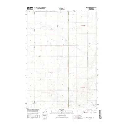
2015 Map of Macs Corner NE
USGS Topo · Published 2015About this map
Green Valley characterizes the southeastern portion of this landscape, where the prairie begins to transition toward the drainage basin of Elm Cr. The terrain is defined by the ephemeral flow of the S Fork Medicine Knoll Cr and Little Wolf Cr, which carve subtle paths through the township sections. This mid-2010s survey captures the rigid agricultural grid of the High Plains, where long stretches of road like 344th Ave follow the north-south section lines, doubling as the Hyde Co Hand Co boundary. While primarily open land, the presence of specific family-named infrastructure such as Lingscheit Pl indicates the scattered ranching and residential sites that anchor the local rural community.
Find a feature on this map
21 named features on this map. Tap any name to fly to it.
Don’t see what you’re looking for? This feature index may not catch every label — zoom into the map to look around manually.
Map Details
Editions of this 2015 Macs Corner NE Map
This is the sole edition of this map. No revisions or reprints were ever made.
Other maps of this area

1950 · Highmore
USGS Topo · 1:24,000

1950 · Ree Heights
USGS Topo · 1:24,000

1950 · Highmore SE
USGS Topo · 1:24,000

1953 · Huron
USGS Topo · 1:250,000

1954 · Huron
USGS Topo · 1:250,000

1973 · Macs Corner NE
USGS Topo · 1:24,000

1973 · Miller Dale Colony SW
USGS Topo · 1:24,000

1973 · Macs Corner SE
USGS Topo · 1:24,000
1973 · Miller Dale Colony NW
USGS Topo · 1:24,000

1973 · Macs Corner
USGS Topo · 1:24,000