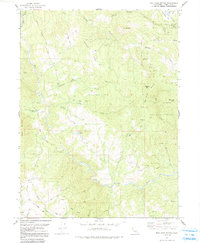
1977 Map of Mad River Buttes
USGS Topo · Published 1991About this map
Six Rivers National Forest blankets this portion of the northern California coastal range, where timber and watershed management shaped the mid-century landscape. The Mad River carves a deep, sinuous path across the terrain, creating the distinct Big Bend where early ranching outposts like Big Bend Ranch were established. High-altitude landmarks such as Rooster Rock and Mt Andy overlook a network of drainage basins including Maple Creek and Boulder Creek. This 1977 survey, based on aerial photography from the late 1960s and early 1970s, documents the transition from early pack trails to the modernization of access roads. While some areas remain accessible only via a 4WD Trail or Pack Trail, established routes like Mountain View Road and Shower Pass Road connect isolated locales like Mt View Ranch and Three Cabins to the wider region.
Find a feature on this map
44 named features on this map. Tap any name to fly to it.
Don’t see what you’re looking for? This feature index may not catch every label — zoom into the map to look around manually.
Map Details
Editions of this 1977 Mad River Buttes Map
2 editions found
Other maps of this area

1914 · Pilot Creek
USGS Topo · 1:62,500

1915 · Big Bar and Vicinity
USGS Topo · 1:250,000

1922 · Korbel
USGS Topo · 1:62,500

1922 · China Flat
USGS Topo · 1:62,500

1922 · Kneeland
USGS Topo · 1:62,500

1945 · Blue Lake
USGS Topo · 1:62,500

1950 · Iaqua Buttes
USGS Topo · 1:62,500

1951 · Pilot Creek
USGS Topo · 1:62,500

1951 · Blue Lake
USGS Topo · 1:62,500

1952 · Willow Creek
USGS Topo · 1:62,500