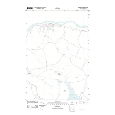
2011 Map of Madawaska
USGS Topo · Published 2011About this map
The Saint John River forms the international boundary in this northern Maine landscape, where the town of Madawaska serves as a primary hub for commerce and transportation. The town's grid, including Riverview St and 19th Ave, fans out from the riverbank near the Madawaska Post Office. Moving inland, the terrain rises toward local peaks such as Cyr Mountain and Morin Mountain, transitioning from the industrial and residential riverfront to more rural crossroads and farming areas.
Find a feature on this map
56 named features on this map. Tap any name to fly to it.
Don’t see what you’re looking for? This feature index may not catch every label — zoom into the map to look around manually.
Map Details
Editions of this 2011 Madawaska Map
This is the sole edition of this map. No revisions or reprints were ever made.
Other maps of this area

1927 · Stockholm
USGS Topo · 1:48,000

1927 · Square Lake
USGS Topo · 1:48,000

1931 · Square Lake
USGS Topo · 1:62,500

1931 · Stockholm
USGS Topo · 1:62,500

1932 · Frenchville
USGS Topo · 1:48,000

1935 · Frenchville
USGS Topo · 1:62,500

1938 · Grand Isle
USGS Topo · 1:62,500

1940 · Grand Isle
USGS Topo · 1:62,500

1953 · Stockholm
USGS Topo · 1:62,500

1953 · Square Lake
USGS Topo · 1:62,500