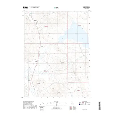
2018 Map of Madeline
USGS Topo · Published 2018About this map
Madeline serves as a central point of reference in this northeastern California landscape, situated at the edge of the expansive Madeline Plains. The geography is defined by a transition from the level basin floors to prominent volcanic uplands, most notably Tule Mtn and Olson Mtn. A significant historical and recreational artery, the LLTT Modoc Line Rail Trail (also labeled as the Modoc Line Rail Trail), follows the path of a former narrow-gauge railroad corridor, connecting the small settlements of Sage Hen, Pinnio, and Madeline. Water resources in this arid high-desert environment are represented by Moon Lake and smaller features like Smith Reservoir and Van Loan Cr. The map details a network of rural roads including Clarks Valley Rd and Olson Rd, which reflect the ranching and agricultural heritage of Lassen County.
Find a feature on this map
29 named features on this map. Tap any name to fly to it.
Don’t see what you’re looking for? This feature index may not catch every label — zoom into the map to look around manually.
Map Details
Editions of this 2018 Madeline Map
This is the sole edition of this map. No revisions or reprints were ever made.
Other maps of this area

1886 · Alturas
USGS Topo · 1:250,000

1886 · Honey Lake
USGS Topo · 1:250,000

1891 · Honey Lake
USGS Topo · 1:250,000

1892 · Alturas
USGS Topo · 1:250,000

1893 · Honey Lake
USGS Topo · 1:250,000

1954 · Grasshopper Valley
USGS Topo · 1:62,500

1954 · Ravendale
USGS Topo · 1:62,500

1954 · Alturas
USGS Topo · 1:250,000

1955 · Westwood
USGS Topo · 1:250,000

1958 · Alturas
USGS Topo · 1:250,000