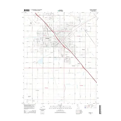
2015 Map of Madera
USGS Topo · Published 2015About this map
Madera serves as the focal point of this San Joaquin Valley survey, illustrating a landscape defined by an intricate network of irrigation and transportation. The city's grid is bisected by the Golden State Blvd corridor, while the Santa Fe Dr line runs parallel to the east, marking the historical importance of rail transit through the Central Valley. Water management is visible in every quadrant, from the Fresno River and its S Fork Fresno River to an extensive system of man-made channels including the Main Canal, Kenney Ditch, and Ripperdan Ditch. These waterways reflect the region's agricultural foundations, supporting outlying settlements like Parksdale, Borden, and Storey. Notable local landmarks such as the Arbor Vitae Cem and the Madera Municipal Airport provide clear geographic anchors for researchers and genealogists tracing the development of the county seat.
Find a feature on this map
95 named features on this map. Tap any name to fly to it.
Don’t see what you’re looking for? This feature index may not catch every label — zoom into the map to look around manually.
Map Details
Editions of this 2015 Madera Map
This is the sole edition of this map. No revisions or reprints were ever made.
Other maps of this area

1912 · Mariposa
USGS Topo · 1:125,000

1916 · Berenda
USGS Topo · 1:31,680

1918 · Berenda
USGS Topo · 1:31,680

1920 · Kismet
USGS Topo · 1:31,680

1920 · Bonita Ranch
USGS Topo · 1:31,680

1921 · Daulton
USGS Topo · 1:31,680

1921 · Bonita Ranch
USGS Topo · 1:31,680

1922 · Gregg
USGS Topo · 1:31,680

1922 · Madera
USGS Topo · 1:31,680

1923 · Herndon
USGS Topo · 1:31,680