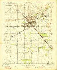
1947 Map of Madera
USGS Topo · Published 1947About this map
The agricultural and industrial center of Madera serves as the focal point of this 1946 culture revision, where the Southern Pacific and Atchison Topeka and Santa Fe railroads converge. The local economy is anchored by the presence of the Madera Winery and the Madera Municipal Airport, highlighting a period of significant post-war infrastructure. Surrounding the urban grid, a network of rural schoolhouses such as Howard Sch, Alpha Sch, and Arcola Sch reflects the distributed farming communities of the Central Valley.
Find a feature on this map
19 named features on this map. Tap any name to fly to it.
Don’t see what you’re looking for? This feature index may not catch every label — zoom into the map to look around manually.
Map Details
Editions of this 1947 Madera Map
This is the sole edition of this map. No revisions or reprints were ever made.
Other maps of this area

1912 · Mariposa
USGS Topo · 1:125,000

1916 · Berenda
USGS Topo · 1:31,680

1918 · Berenda
USGS Topo · 1:31,680

1920 · Kismet
USGS Topo · 1:31,680

1920 · Bonita Ranch
USGS Topo · 1:31,680

1921 · Daulton
USGS Topo · 1:31,680

1921 · Bonita Ranch
USGS Topo · 1:31,680

1922 · Gregg
USGS Topo · 1:31,680

1922 · Madera
USGS Topo · 1:31,680

1923 · Herndon
USGS Topo · 1:31,680